

Seeing Earth in False Colour
At Umvoto, Sentinel-2 False Colour Composite (FCC) imagery is a working tool, not only a striking visual. By combining selected multispectral bands, FCC images make vegetation, moisture, lithology, and structural lineaments stand out more clearly than in a natural-colour scene. That contrast helps inform aquifer and catchment assessments from surface and structural context, track land-use and vegetation change, and plan fieldwork where geology is subtle or access is difficult.
We use Sentinel-2 False Colour Composite products across hydrogeological assessments, integrated water resource work, and regional geological interpretation — from drought-resilience projects around Cape Town to exploration and research landscapes further afield. The six panels on our Muizenberg office wall are a public window into that practice: each scene is a real Sentinel-2 False Colour Composite of a place that matters to Umvoto’s story and science.

Danakil, Ethiopia
In one of the harshest environments on Earth, where heat shimmers off alien terrain, False Colour Composite imagery becomes more than a tool — it is a gateway. Through these enhanced visuals, Umvoto navigates the complex geology of the Danakil Depression, enhancing contrast between lithologies and surface materials that are harder to separate in natural-colour imagery. Here, resilience defines both the land and the team, enduring extreme conditions to advance groundwater exploration where few dare to tread.

Sentinel-2 False Colour Composite image highlighting salt flats, volcanic flows, and hydrothermal deposits across the Danakil Depression. Extent: 12°41’27″N 40°59’30″E to 13°41’09″N 42°10’03″E.
Kuiseb River, Namibia
Where desert meets stone, the Kuiseb River cuts a line through time. This ephemeral desert river, with its stark contrasts and shifting landscapes, was among the first to shape Umvoto’s FCC mapping approach. The imagery not only helps interpret surface geology and drainage patterns, but honours a region central to Umvoto’s legacy — a place where geological insight and innovation first converged in the quest for sustainable water futures.
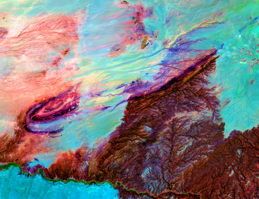
Sentinel-2 False Colour Composite image showing the winding Kuiseb River cutting through desert dunes and rocky outcrops. Extent: 23°46’38″S 15°03’44″E to 23°26’46″S 15°39’03″E.
Oudtshoorn, South Africa
A cornerstone landscape in Umvoto’s history, Oudtshoorn epitomises our commitment to groundwater development, monitoring, and research, and to water security through sustainable management. The Sentinel-2 False Colour Composite of the Little Karoo valley is a tribute to the region’s place in Umvoto’s legacy and expertise.

Sentinel-2 False Colour Composite image depicting the semi-arid Little Karoo valley with cultivated lands and surrounding quartzitic mountain ranges of the Table Mountain Group / Cape Fold Belt. Extent: 33°42’01″S 22°00’00″E to 33°24’00″S 22°30’00″E.
Tankwa Karoo, South Africa
Minimalist and immense, the Tankwa Karoo stretches in silence — until viewed through FCC imagery. Then subtle geological structures emerge, revealing a landscape shaped over millennia. For Umvoto, this region is a study in contrast and continuity, using satellite data to refine our understanding of earth processes and supports targeted exploration in South Africa’s semi-arid heartland.

Sentinel-2 False Colour Composite image revealing arid plains, dry river channels, and rugged geological formations of the Tankwa Karoo. Extent: 32°42’02″S 19°22’03″E to 31°50’45″S 20°33’54″E.
Cape Peninsula and Table Mountain Group
This south-western Cape scene, including Table Mountain Group (TMG) terrain around the Cape Peninsula and towards Hermanus, is central to major Umvoto work on Cape Town’s water resilience and drought mitigation. TMG fractured-quartzite aquifer systems — their recharge, compartmentalisation, and structural controls — underpin those initiatives. Sentinel-2 False Colour Composite imagery here supports monitoring of vegetation health, land-use change, and landscape context relevant to water resources — informing strategic decisions for drought mitigation and the sustainable management of water and environmental systems in the region.

Sentinel-2 False Colour Composite image illustrating the Table Mountain Group ranges and coastal vegetation patterns around the Cape Peninsula.
Extent: 34°24’03″S 18°12’00″E to 33°42’00″S 19°00’00″E.
Richat Structure, Mauritania
From orbit, it appears as a concentric “bull’s-eye” carved into the desert — the Richat Structure, or “Eye of the Sahara.” Within its rings of uplifted rock — concentric ridges of differentially eroded sedimentary rocks — lie stories of erosion, uplift, and Earth history. FCC imagery brings these patterns into focus, supporting geological interpretation of this iconic landform. For Umvoto, this emblematic feature reflects the power of satellite observation to connect the beauty of remote landscapes with real-world geological insight.
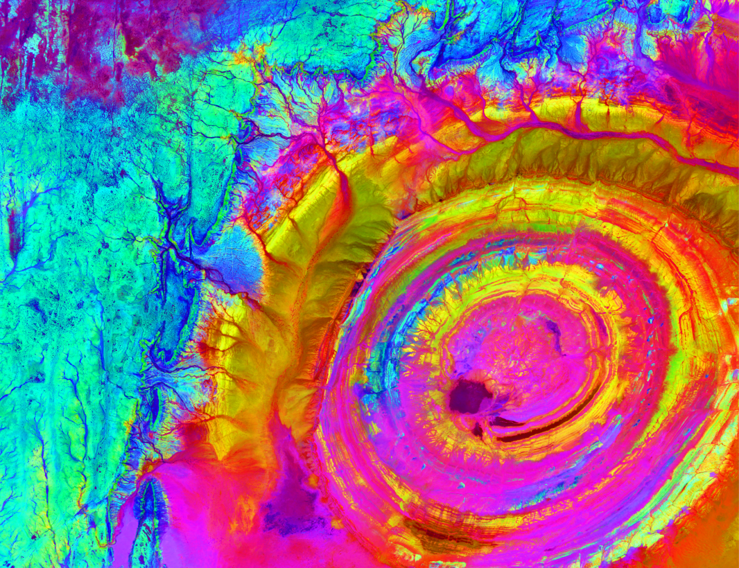
Sentinel-2 False Colour Composite image revealing concentric rings of uplifted rock — differentially eroded sedimentary ridges — and desert sands forming the Richat Structure in the Sahara. Extent: 20°09’46″N 13°08’42″W to 21°49’46″N 9°58’12″W.
From wall to web
These Sentinel-2 False Colour Composite scenes invite passers-by to look again at familiar and distant Earth. Online, they open into the science: how Umvoto reads FCC imagery to support groundwater exploration, water security, and sustainable earth-science practice. For more on our services and approach, visit our website.
